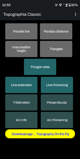
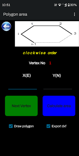
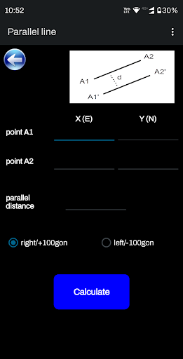
Features Topographia Classic
"Topographia Classic" is a suite of land surveying tools.
It allows you to have complex surveying calculations on the field quickly with maximum accuracy.
The design is as simple as needed under work pressure.
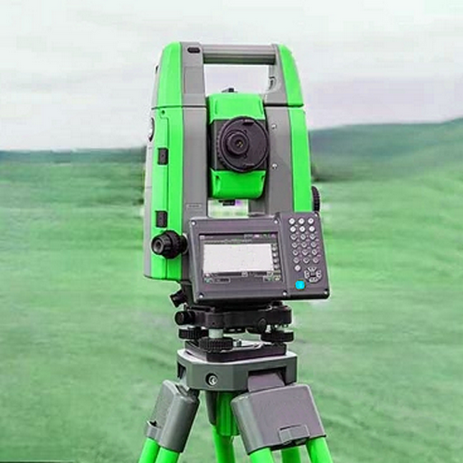
The advantage is that can be used only with a simple total station or additionally with more complex instruments and gps.Angular units : gradians (default) and decimal degrees (degrees only in Distance/Azimuth).Task list:Parallel linesParallax distanceInaccessible heightTriangles solutionPolygon AreaLine extensionLine thickeningTrilaterationPerpendicular lineArc informationArc thickeningGreat tool for land surveyors, civil engineers, topographers and land engineers.Download also our free application:"Geodetic NET" from Google playhttps://play.google.com/store/apps/details?id=com.GeodeticNET&hl=en"Surveying In the Field" from Google playhttps://play.google.com/store/apps/details?id=com.Surveying.IntheField&hl=en"Topography On the Fly" from Google playhttps://play.google.com/store/apps/details?id=com.TopOgraphy.OntheFly&hl=en&gl=US&pli=1Dont forget to rate this app and send us a feedback.
Gaming Features
Enjoy immersive gaming experience with various game modes.
Fitness Tracking
Track your workouts and monitor your health metrics.
Productivity Tools
Boost your productivity with powerful tools and features.
See the Topographia Classic in Action
Get the App Today
Available for Android 8.0 and above